
Maps/Streams and Ditches
East Maui Streams and Ditches

Date: 2004
Size: 5 MB
Source: Fukumoto Engineering
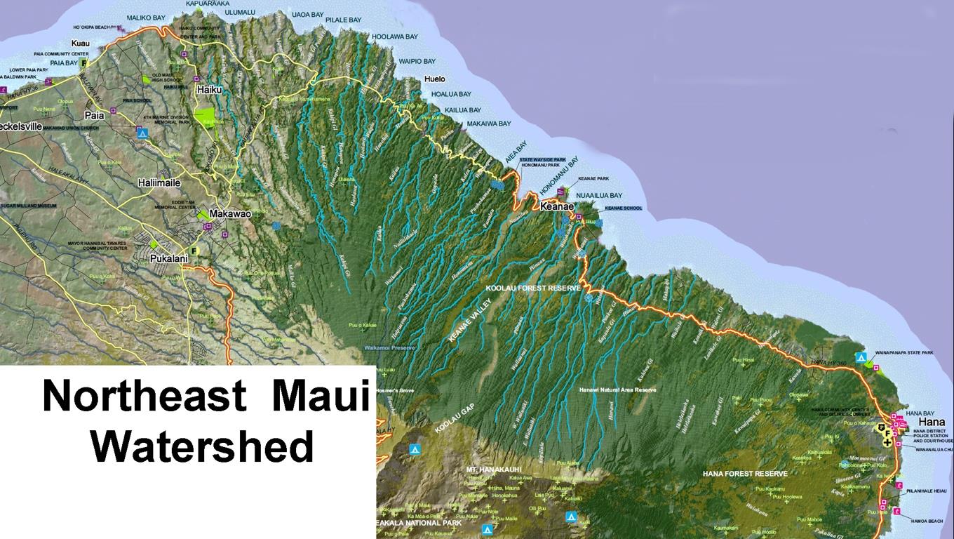
Koolau ditch map
Close up of ditch system from East Maui diversions

Date: Unknown
Size: 1 MB
Source: USGS
Stream restoration map- 2019-09-23-DEIS-APP A-E-Maui-Water-Lease Stream evalHSEP
Map of the effect the 2014 contested case had on IIFS for East Maui streams

Date; 2019
Size: 300 KB
Source: EIS
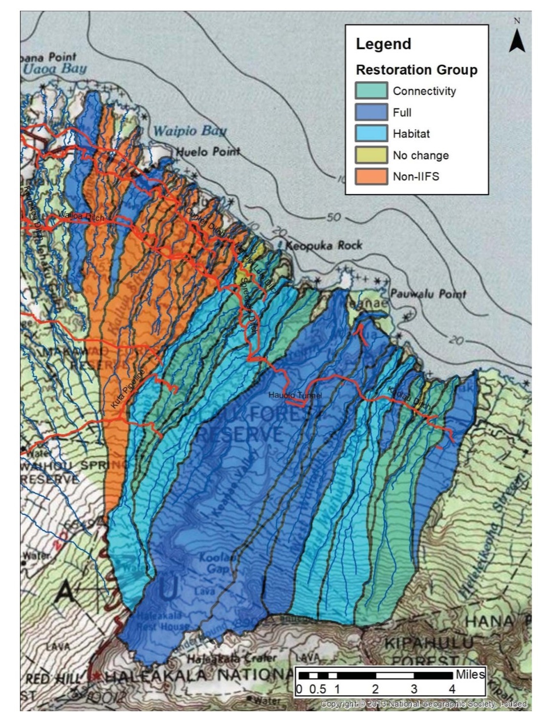
sb20221115B5-CWRM Submittal B5 to restore Huelo streams [7]
Map showing the Huelo streams that are the subject of CWRM staff recommendation for restoration

Date: 2022
Size: 700 MB
Source: CWRM
Plate_1-USGS-2004-Report
Detailed map of all East Maui streams with watershed boundaries for each streams. This is PDF and can be zoomed-in to see details.

Date: 2004
Size: 14 MB
Source USGS
Download/View
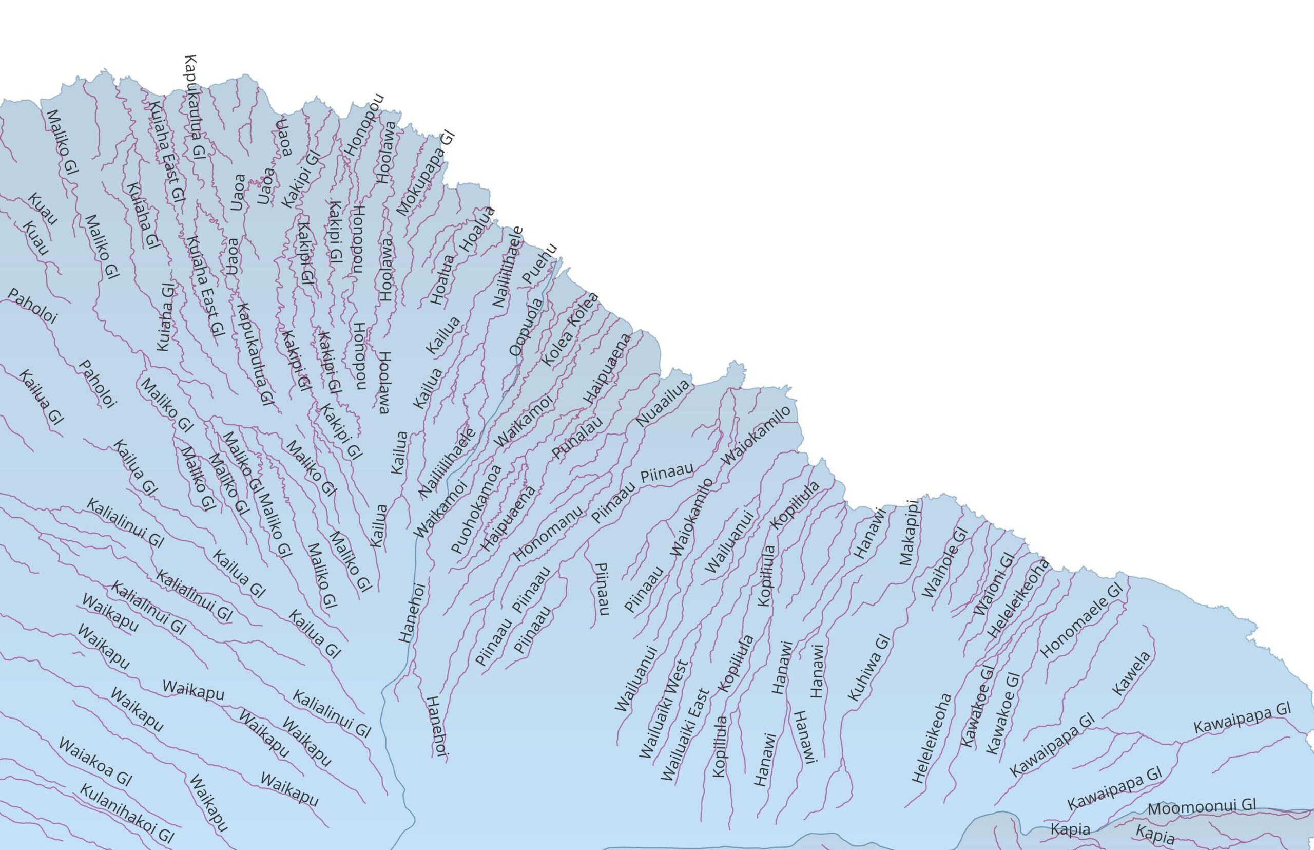
E-30-A_20150311_0001
Detailed map of Huelo area streams

Date: 1926
Size: 6 MB
Source: EMI
EMI Site Visit Big Map copy 3
Details on Wailuanui and E, W Wailuaiki

Date: Unknown
Size: 1 MB
Source: LDN
East Maui Streams
This map comes from the State mapping program and shows all streams, even ones not under CWRM oversight. We can make zoomed-in versions of this, let us know.

Date: 2024
Size 1 MB
Source: Hawai’i State GIS Program
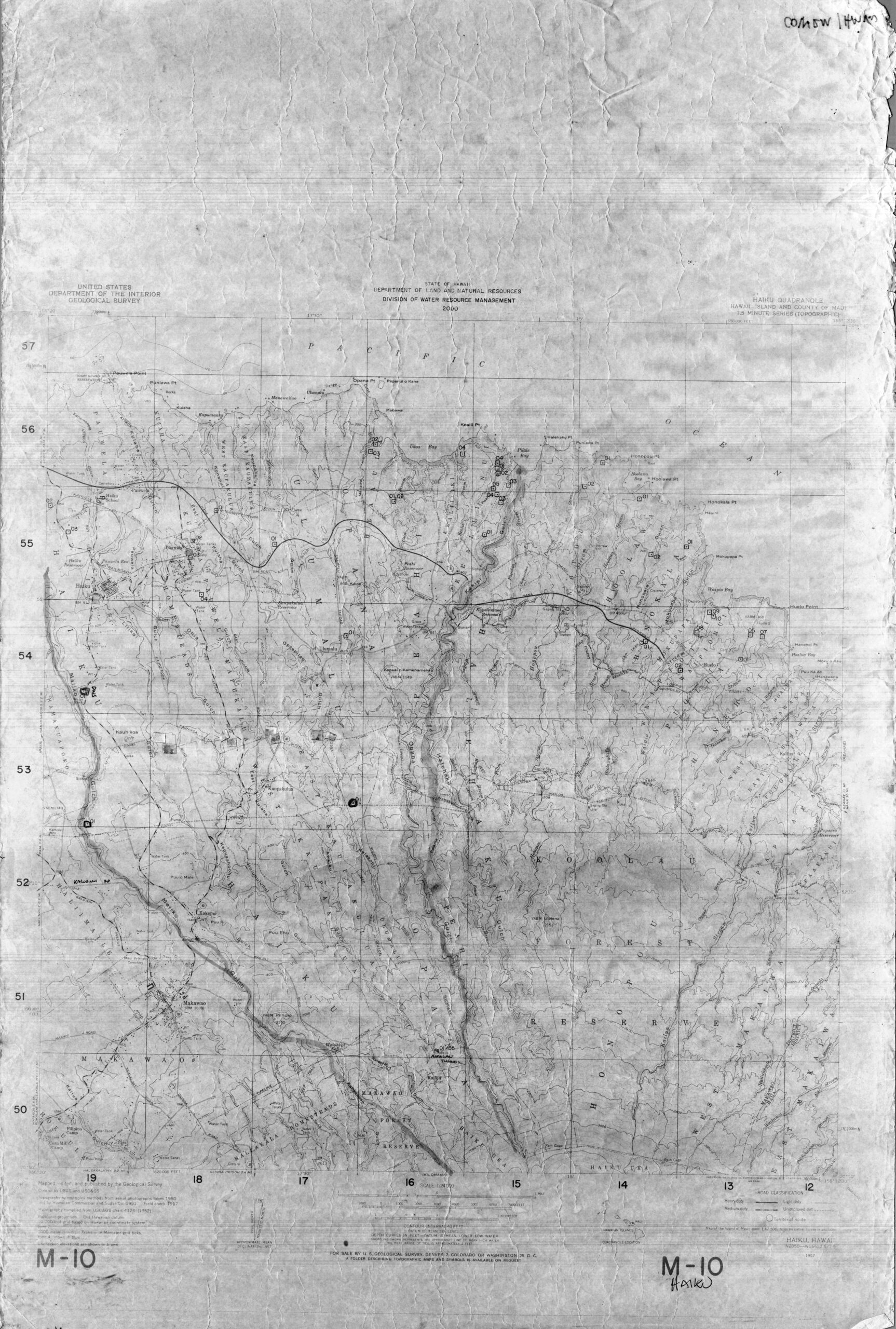
Hawaii DLNR Stream Map
Old hand-drawn map of lease area. It is extremely detailed and should be zoomed into.

Date: 1957
Size: 150 MB (!)
Source: DLNR
East Maui Ditches – Water Losses map copy
Map of ditches that show seepage rates.

Date: Unknown
Size: 2.6 MB
Source: USGS
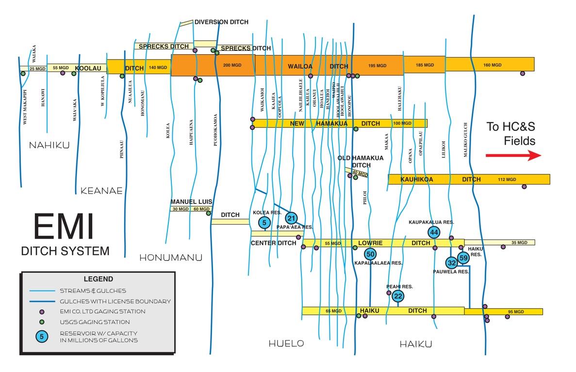
EMI Ditch Schematic
Nice visualization of which stream is diverted into which ditch system

Date: Unknown
Size: 1 MB
Source: EMI

A&B-reservoirs – A&B DES- MDWS system map

Date: Unknown
Size: 1.5 MB
Source: Wilson-Okomoto
2017-02-08-MA-5E-EISPN-E-Maui-TMK Map
Map of E. Maui Watershed lease areas by TMK

Date: Unknown
Size: 2 MB
Source: Wilson & Okamoto
2017-02-08-EISPN-EMaui-Water-Lease Stream map
Lease area with all streams affected by the lease marked

Date: 2017
Size: 1 MB
Source: Wilson & Okamoto
2017-EISPN-Water-Lease Ditch map
Map showing connection between EMI ditches and MDWS upcountry supply

Date: 2017
Size: 1MB
Source: Wilson & Okamoto EIS
E MauiUH presentation Extract[22]
Map of average daily water usage from EMI to MDWS system

Date: Unknown
Size: 1 MB
Source: LDN
East Maui Phase 4 Solicitation Package.August_2024 [3]
Map of Haiku streams being considered for restoration

Date: 2024
Size: 1 MB
Source: Brown and Caldwell